
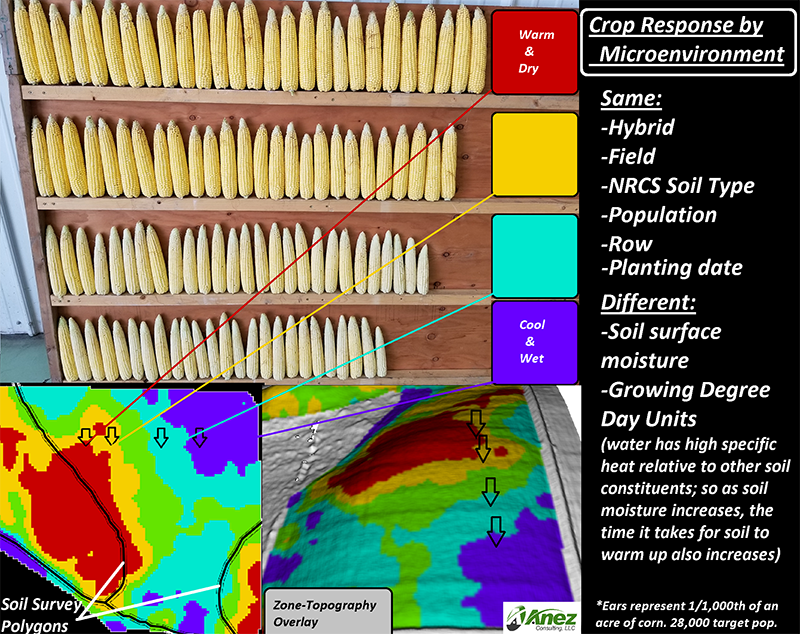
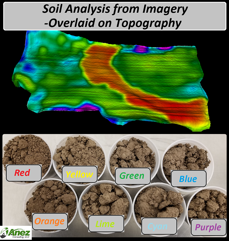
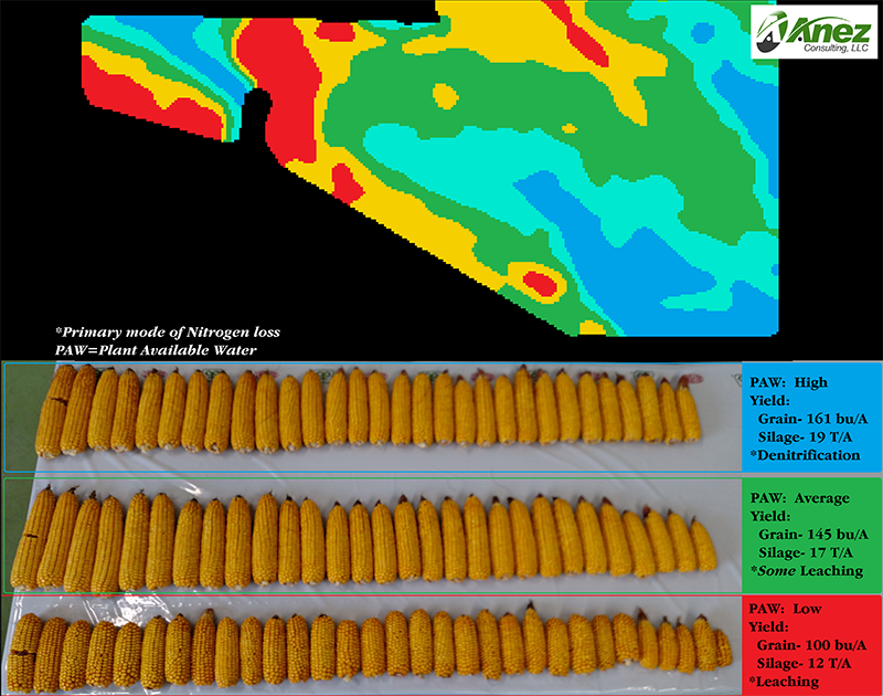
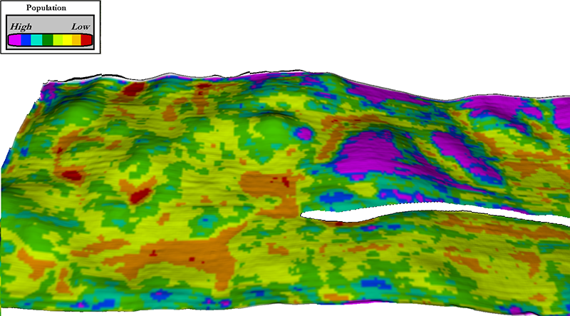
Soil Analysis and Management Zone Creation
We offer management zones that line up with soil properties and don’t change from year to year, unlike zones built using NDVI and yield maps. These zones also reflect soil changes with greater granularity than NRCS soil map units. Our soil analysis is among the highest resolution soils data in the industry!
- Zones are delivered in a format that growers, scouts, and agronomists can easily visualize and geo-reference with most mobile devices (Android, iOS, Windows)
- Zones are formatted to readily be imported into most Farm Management Software and GIS programs
- Can create zones from a variety of imagery sources: multispectral and RGB imagery from UAV and manned platforms
- Soil sampling by zone informs variable rate fertilizer, lime and other amendments
- Zones are an effective way to variable rate seed and can be used for variable rate irrigation
- Can be used to identify regions in need of replant before NDVI can be acquired
- Zones are derived from the highest resolution soils data in the ag industry
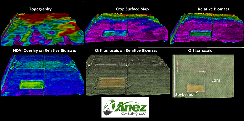
Relative Biomass Modeling
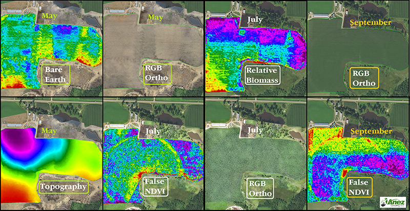
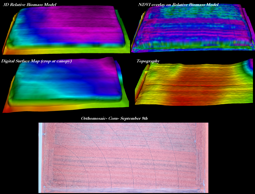
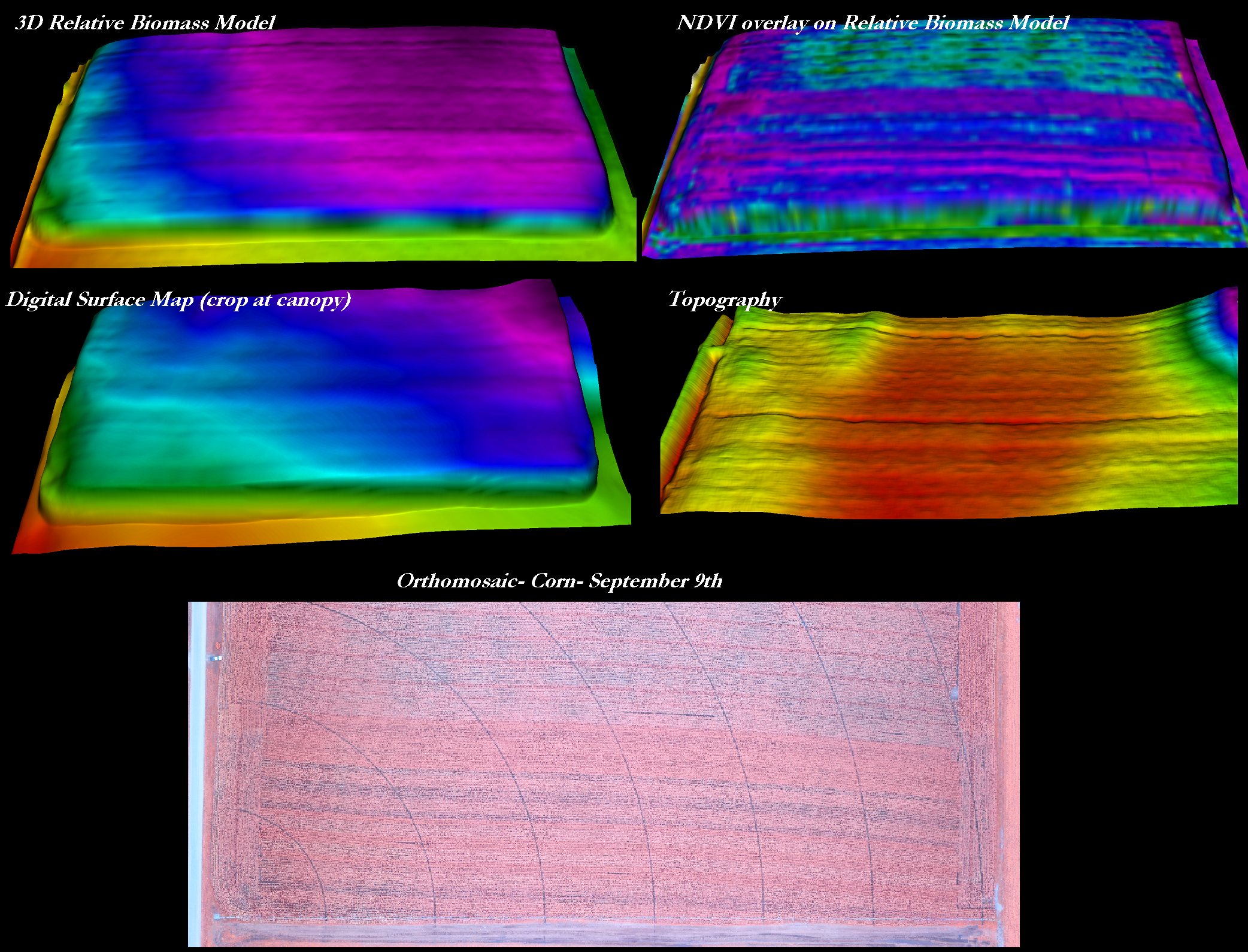
Using properly-timed UAV imagery, we can create 3D relative biomass models that reflect changes in the height/density of crops (not just reflectance values, like NDVI and other Vegetative Indices). While NDVI is still the preferred method of delineating changes in crop health, it can be relatively weak in providing context for how things are changing. Advantages of 3D relative biomass include identification of planter skips, lodging events, residue management issues and other problems that affect the height of the crop and have inconsistent affects on crop reflectance (NDVI).
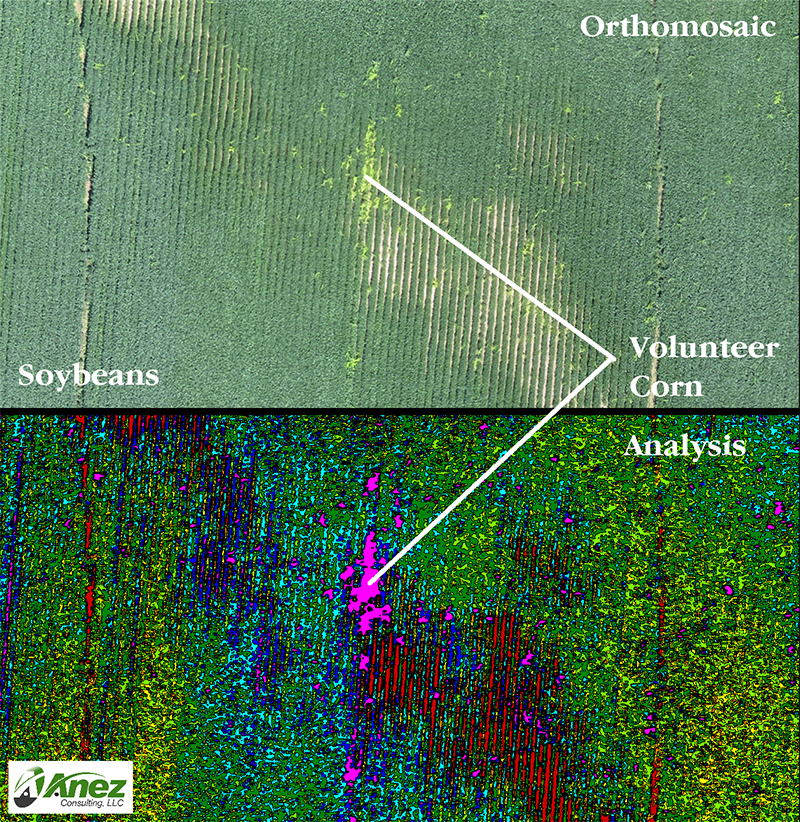
Aerial Imagery to Classify Agronomic Issues
Beyond NDVI, we can use UAV-derived aerial imagery to assess a variety of agronomic issues, such as:
- Areas in need of replant
- Classification and documentation of weed infestations
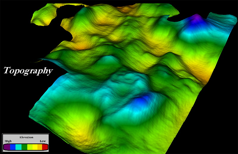
- Map topography for various types of terrain analysis
- Stand counts and gap analysis with economic reporting
- Improve late season yield estimation
- Document fertilizer and herbicide misapplication
- Document plant health issues that result from disease, insects, weather and other agronomic issues
Precision Agronomy and Pioneer Seed
Connect with Anez Consulting to help with your farming needs.